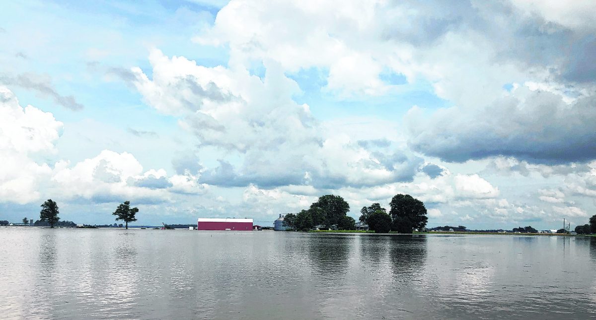
Jackson County has received more rainfall this past week than the 38 other counties in the National Weather Service in Indianapolis’ coverage area.
Meterologist Kacie Hoover said Jackson County has received 8.24 inches in the last seven days.
“Isolated areas have more or less than that amount in Jackson County,” she said.
[sc:text-divider text-divider-title=”Story continues below gallery” ]Click here to purchase photos from this gallery
Only Brown, Lawrence and Monroe counties — all which border Jackson — had measurements above 8 inches in that area during the same time period.
That nearly matches the Brownstown Central High School weather station’s data, which shows 9.08 inches so far this month. According to the station’s data, the area has received 34.61 inches this year, which is 12.3 inches more than average. One year ago today, the county had received 26.08 inches on this day.
That amount of rainfall has caused flooding in an already saturated area as rains have persisted all spring.
While recent flooding has contributed to issues, Hoover said there doesn’t seem to be an end in sight over the next week.
Heavy rains are expected today and Thursday before a break Friday. Rain will continue between Saturday and Tuesday, Hoover said.
“Between now and Tuesday evening, we’re predicting Jackson County will receive an additional 5 inches of rain, according to our latest models,” she said. “It’s going to keep raining, and more flooding is coming.”
Rainfall has persisted due to a continuous pattern of disturbances in the upper atmosphere, Hoover said. That combination has created an environment that encourages rainfall and slow-moving storms.
“We’ve had slow-moving systems that have picked this area,” she said. “Further west toward the Mississippi River has had historical flooding, so it’s not just Indiana that’s getting a lot of rainfall.”
The rainfall has caused much flooding throughout the county and has swelled the East Fork White River into a moderate flood stage.
The river will remain above flood stage through the remainder of this week.
At 2 p.m. Tuesday, the river stood at 17.9 feet at Rockford and looks to remain near or at that level throughout much of the day. Flood stage is 12 feet, and at 17 feet, moderate flooding is occurring.
At 17.5 feet, extensive agricultural flooding is in progress, according to the National Weather Service, and many county and state roads in the floodplain become impassable by high water.
These include State Road 235 east of Medora, State Road 258 east of Cortland, County Road 725N and possibly State Road 39 south of Tampico. High water also affects county roads near Vallonia and Shieldstown, Ewing Road near Brownstown and County Road 525N near Seymour’s wastewater treatment plant.
Also, Honeytown Road and possibly State Road 250 east of Dudleytown and State Road 256 west of Austin.
That flooding has made the job of first responders difficult with at least 17 water rescues conducted since June 1, according to the Jackson County Sheriff’s Department. That represents nearly a third of the 55 the department has conducted since the beginning of the year.
One of those incidents ended badly in more ways than one for a South Bend man.
Police were called to an area near County Road 800N at 7:18 a.m. Tuesday from a resident who reported a vehicle was stuck in the water.
Dustin Lee Newman, 32, had driven through the floodwaters with a passenger in a 2020 Volkswagen and became stranded. The two found an island between floodwaters before emergency crews arrived.
Officer Chris Hubbard, who responded to the rescue, said water was flowing swiftly in the area.
Police found Newman had a warrant for intimidation in Michigan. He was arrested and booked into the Jackson County Jail in Brownstown at 9:57 a.m.
OFficer Brad Barker responded to a water rescue Monday evening to help a 22-year-old woman who became stranded near Shieldstown.
Mary Jane Dewitt told officers she was trying to reach SpringHill Camps on State Road 258 when her GPS guided her to an alternate route. The Brownstown Volunteer Fire Department assisted with the rescue.
Police took Dewitt to meet her parents in Seymour following the rescue. Her 2001 Ford Taurus remained in floodwaters.
Jackson County Highway Superintendent Jerry Ault said his team has been busy putting up flood signs in affected areas, clearing debris left by flash flooding and making repairs.
Heavy rain caused issues on two dead end county roads in central and western Jackson County.
Flash floodwaters washed riprap and asphalt away on County Road 825W in Salt Creek Township.
Water tore up asphalt on County Road 640W in Freetown, too.
“It didn’t completely wash the road out but did damage,” Ault said. “We have a lot of issues on those roads when we get a lot of water at once.”
The rescues and issues from floodwaters follow a difficult weekend for motorists in Jackson County.
Motorists were slowed Sunday on Interstate 65 between Seymour and Uniontown after floodwaters crossed the roadway.
U.S. 31 also had significant flooding in parts of Jackson County.
City streets, including Second, Tipton, O’Brien and more, also had high flash flooding.
Jackson County Sheriff Rick Meyer said motorists should remain aware of road conditions and should not risk driving through floodwaters.
“Even if your GPS tells you to go that way, you have to use common sense,” he said. “We always promote ‘Turn around, don’t drown.’”
